Sunday, December 31, 2023

Is that snow I see?

TL;DR: Two shortwave troughs pass to our south missing northern Utah, one today and one Monday night. A ridge builds its way into the region mid-next week. A promising low-pressure system could bring snowfall to northern Utah later next week.

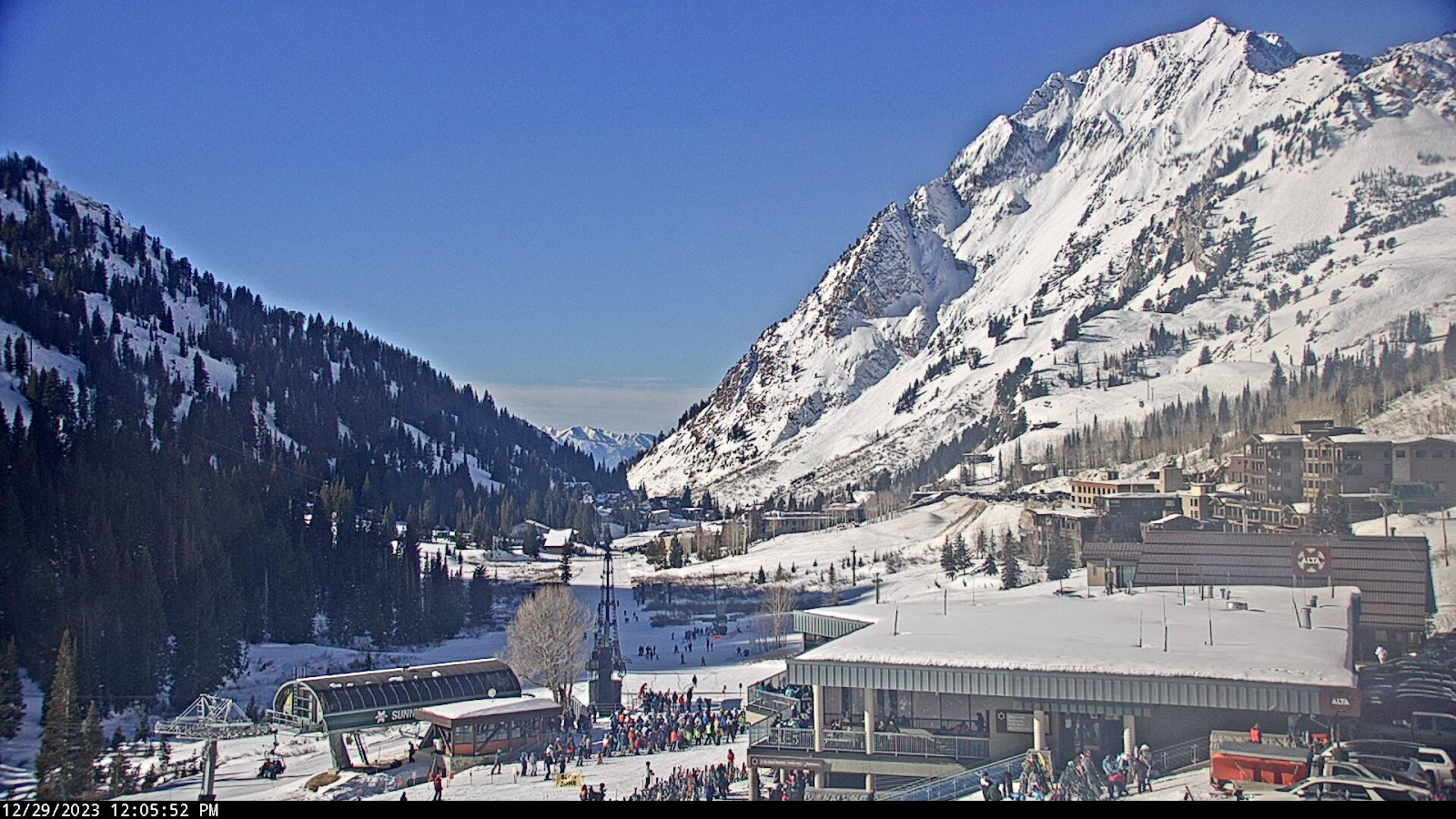
Nowcast: It is currently 24 F at the top of Alta-Collins with clear skies and light winds. A surface inversion has built in the valley floor from the surface to about ~800 mb. Luckily with the passing of a deeper trough to our south, some weak systems associated with the larger system move their way through northern Utah providing a way for this inversion to mix out.


(SPC Soundings: https://www.spc.noaa.gov/exper/soundings/. Valley inversion circled in blue showing temperatures increasing with height until ~800 mb. This is the reason for any haze this morning. This inversion should weaken over the next couple of days as weak storm systems slightly decrease temperatures and provide some mixing.)

Short-Term: Nothing interesting to note here, calm weather with temperatures slightly decreasing over the next couple days which will help to weaken any inversion in place.

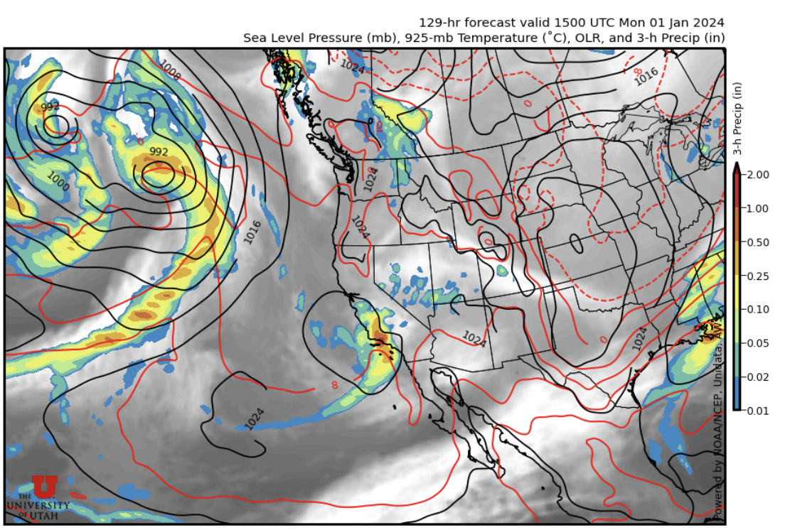
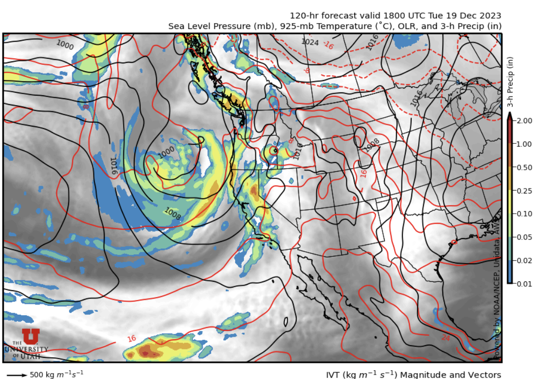
(Utah Weather Center: https://weather.utah.edu/. The left plot shows high pressure “H” that builds into the region around Wednesday (3am) and the low-pressure system “L” that will quickly kick out the high bringing snowfall to northern Utah later next week. Right plot showing precipitation associated with that low off the Pacific coast.)

Long-Term: High pressure builds into the region around Wednesday next week. Low pressure moves in around Friday along with snowfall. Stay tuned for future forecasts as we learn more about the next storm.

(Utah Weather Center: https://weather.utah.edu/. Long-term models are picking up on snowfall later next week. Totals aren’t important here, the signal is.)

If you are headed in the backcountry visit UAC to #knowbeforeyougo. 

Saturday, December 30, 2023

Possible snow showers today, possible storm next weekend

 TL;DR

Aside from a few potential flakes today, we will remain mild and dry to close out the year. Models are showing the possibility for a storm next weekend, but low confidence on the details will preclude any further discussion right now.


Nowcast:


Our lovely local KMTX radar is showing some mostly light precipitation over northern Utah this morning, with the exception of one stronger cell SSW of the Cottonwood Canyons:


KMTX radar, courtesy of the National Weather Service

This will continue on and off throughout the day, accompanied by mild temps (in the 30s °F) and light winds.

Short term


The short-term is the same as the nowcast, with the change being that the clouds will clear out for New Year's Eve.


Long term


The next feasible period for snow looks to be about a week from now. Here's what the University of Utah model plumes are showing for Canyons:


The model plumes for Canyons, courtesy of the University of Utah Department of Atmospheric Sciences


They're at least showing something.


I'm not going to speculate on the details right now because seven days out is a long way out, and the storms this season have had a tendency to weaken as we enter the higher-confidence 2-3 day window. But rest assured that we at Utah Ski Weather will be keeping an eye on it, and once we have higher confidence, you will know the details...


Have fun skiing in the resorts, or if you're venturing into the backcountry, make sure you have the proper equipment and know before you go. For the whole avalanche forecast and all things avalanche head over to our friends at the Utah Avalanche Center.


Friday, December 29, 2023

Blue Skies While Ullr Cries

TL;DR:

Blue Skies, and what I call a "sunscreen day". More of the same through the new year.

Nowcast:

Today is a good day to remember sunscreen and a warm jacket! The holiday crowds are here as seen on the Alta Superior Webcam. Temperatures just below freezing under the blue sky today.


Superior Webcam Courtesy Alta


Short-Term:

Our friends on the Pacific coast should be seeing some precipitation throughout today with a winter storm warning in the Sierras. This trough is expected to die out as it approaches our area, maybe showing up as some high cirrus clouds later tonight. Some high clouds persisting overnight could lead to warmer temperatures, and spring-like snow could exist in the next few days. 

Long-Term:

The split flow that was mentioned in Nic's forecast yesterday will remain the story for our long-term forecast. For the start of our new year, the upper-level trough that is currently sitting off the coast of California will dissipate and likely miss Utah. Another High-Pressure Ridge is expected to start building over Utah by Tuesday next week. For now, get out and enjoy the sun and ski some corn for me (I am in Florida missing these great conditions).


4 panel showing dry conditions after trough passes early next week courtesy weather.utah.edu


If you plan to travel in the backcountry make sure that you are prepared with not only the gear but the knowledge as well. Check in with our friends over at the Utah Avalanche Center for a full avalanche forecast, observations, and all other things avalanche. 

Thursday, December 28, 2023

Snow Dance, More Snow Dance

TL;DR:

Much of the same for the foreseeable future. High pressure and clear weather. They do say that sunny skies make for the best weather conditions for doing the snowdance. We expect to see you powder puppies snow dancing all around. 

Nowcast:

Current conditions in the Wasatch have temperatures around 40°F at mountain bases and just below freezing at mountain tops. Mostly clear skies throughout the day. 

A beautiful evening looking at the sunset behind superior, courtesy of Alta


Short-Term:

Utah sits under a ridge of high pressure as we go into the weekend. Warmer mountain temps will persist through the next couple of days. Although a moist trough sits off the west coast, a strange pattern of split flow looks to be on the way that will prevent it from bringing us any sort of precipitation. 

Long-Term:

The split flow that was mentioned above can be seen in the graphic below. This map shows the 500mb surface level forecast valid Friday 18z through Sunday 9z. At the start of the loop, the trough that approaches the west coast splitting. The flow travels north and south of Utah, leaving us devoid of any sort of favorable snow conditions. 

Pivitolweather.com

Beyond the start of the new year things are looking meager, we may have to start 2024 on a dry note. That said, get out and enjoy the sun while you can!

If you plan to travel in the backcountry make sure that you are prepared with not only the gear but the knowledge as well. Check in with our friends over at the Utah Avalanche Center for a full avalanche forecast, observations, and all other things avalanche. 


How to Snow Dance:

Wednesday, December 27, 2023

Quiet Week

  TL;DR:

Storm affecting the West Coast, does not look like it will cause a lot of accumulation here


Nowcast:


tropicaltidbits.com

The high pressure system remains in control over Utah today. There is a trough and associated low pressure system over the West Coast, which is mostly bringing rain to coastal areas in the PNW. A system is also bringing some mild snow accumulations to the Plains. As of 8 AM today there was an inversion on the mountain, with temps at 18 degrees at 8,500 ft, and temps of 21 degrees on the mountaintops.


Short term:


Model runs unfortunately show that the system bringing precipitation to the PNW will not survive inland. Small accumulations with this are possible but it does not seem like it will be anything notable. High pressure and generally clear skies will be the norm as the high pressure system will stay in the area for the rest of the week. 


Long term:


weather.utah.edu


The next storm is forecast to affect the West Coast over the weekend. There is the possibility for it to bring moisture and associated snowfall early next week. Stay tuned for an updated forecast on the next potential snowfall here!


Backcountry comments:


If you will be traveling in the backcountry make sure you have the proper equipment and know before you go. For the whole avalanche forecast and all things avalanche head over to our friends at the Utah Avalanche Center.


Monday, December 25, 2023

It's Christmas, believe it or not.

 TL;DR:

Clear weather for the foreseeable future, unfortunately any snow will be quite limited.

Nowcast:


Partly cloudy, with a high of 34 degrees. Temperatures at Alta range from 3 degrees at the base to 13 degrees at the top of Collins. 

Short term:


High pressure over the next several days that will prevent snow. Expect temperatures to keep on rising throughout the week. Due to this high pressure, air quality could get worse throughout the week until the next storm system arrives. Thankfully, a cold front hit several days ago to clean out the air.

We see that the air quality got better quickly on Saturday, but now it's starting to rise again. It feels like an endless cycle, we have an inversion, we get snow that clears out the inversion, then we get another inversion. As the inversion builds, we could see higher temperatures in the valley compared to the mountains. 


Long term:


As of right now, it appears like the weather over the next week is going to remain the same. The GFS shows high pressure remaining over Utah for a while, with some isolated precipitation systems potentially making their way to Utah. I hope that the start of the new year causes the overall outlook for the season to look better.


Backcountry comments:


If you will be traveling in the backcountry make sure you have the proper equipment and know before you go. For the whole avalanche forecast and all things avalanche head over to our friends at the Utah Avalanche Center.


Saturday, December 23, 2023

It's beginning to look a lot like Christmas

TL ; DR: The closed low over the southwest U.S. has merged with the strong vorticity max over the interior mountain west which will fuel continued mountain precipitation today into tonight. Mountain precipitation will continue through tonight into early Sunday. Once this system passes through, a ridge will build into our region. 

Short Term:

A front has passed through this morning, with dropping dew points. Mixing from this system will help to remove any leftover pollution from the previous inversion this past week. Now that we are post frontal, we are seeing northwesterly flow at the surface, helping to advance orographic precipitation.

 As the system continues to move eastward, precipitation in the valley will fizzle out by this afternoon and mountain precipitation will continue through the evening. The mountains are predicted to receive 1-5" of snow through the day today with up to 1" of SWE. 

Long Term:

By late Sunday, the trailing ridge will build over Utah. This will bring more calm weather with highs in the mid 30s and lows near the 20s for the next few days. This ridge will persist through the week. 

Backcountry Comments:

If you are planning to travel in the backcountry, be sure to check the forecast at Utah Avalanche Center.

Friday, December 22, 2023

Here Comes Something

TL; DR: Low pressure has reached southern Utah and will linger through Saturday night. As for us, a cold front will shift to northern Utah beginning Saturday morning (tomorrow). Once this low pressure exits the Wasatch, we will be back in high pressure persisting until at least midweek of next week. 


Also! My name is Benji. I have not been set up with an account to access this blog yet, so Colin was nice enough to let me post under his. Sorry for the confusion. 

Nowcast: 

Lucky me. This will be my first ever weather forecast, and it just so happens to fall on the first full day of winter (Astronomically speaking, that is). 

Temps are high around the valley, with most observations reporting low 50F's. Unlike earlier in the week however, there is no noticeable inversion (mountain temps hover close to 40F). 

Unseasonal temps for Salt Lake Valley as of Dec 22 via https://www.wrh.noaa.gov/map/?obs=true&wfo=slc

Collins Gulch located at Alta Ski Resort as of 1130AM local time sits at 28F, with plenty of decent to good skiing to be had. 


As noted earlier in the week, PM2.5 began their decent on Tuesday, and have stayed low since. This doesn't have much effect on us as skiers, but as human being living in the valley, this has been a great help. 

PM2.5 Time Series for the past 7 days via https://utahaq.chpc.utah.edu

Lastly, let's take a look at the water vapor channel from above. We see a light system brushing the southern portion of our state, with a stronger system hovering around Arizona and Southern California. (Note the difference shades of green). 

Short Term: 

There is much agreement that a system will begin to affect the region as of 6:00AM local time on Saturday. We can expect up to 10", however, some models suggest as low as 2". Given the season we have had thus far, I am going to go ahead and call this worthy of a white Christmas. However, feel free to ignore my exaggeration and note the plateauing line as seen below. Good news is we can at the least expect for our smog to dissipate entirely at least for the moment. 

Ensemble plumes via https://weather.utah.edu


Long Term; 

Keep an eye on whether or not this system lingers for longer, or if we get stuck back in a high pressure system going towards the end of the calendar year. 

Backcountry Comments: 

The compass is green. Whether or not those big backcountry missions you have circled in your to-do notebook contain enough snow for fun riding conditions remain to be seen, but travel to should be safe. As always, don't do anything careless. 

No avalanches have been reported recently, but do check out this nicely written summary from Mount Wolverine near the top of Little Cottonwood: Mt. Wolverine Obs

Thursday, December 21, 2023

Snow Is Coming

TL;DR: High pressure persists through Friday with a shortwave trough hitting northern Utah on Saturday morning bringing snowfall to the Wasatch. Snowfall totals associated with the shortwave trough are all over the place. For reference, Alta would be fortunate to get above 5”.

NOWCAST: It is currently 32 F at the base of Alta with partly cloudy skies and light winds.

(Alta:https://www.alta.com/weather) 

Short-Term: Our snow-drought will continue until ~11am Saturday morning when a cold front moves its way into northern Utah, lowering the freezing level to the valley floor. Post-frontal winds will be out of the NW and peak on Saturday night while temperatures will drop into the teens by Sunday morning. Snowfall totals will likely be anywhere between 2-6” at Wasatch resorts. Not quite the storm we are looking for, but we will take it.

(Utah Weather Center: https://weather.utah.edu/. The shortwave trough axis is shown in blue. This is what is bringing our snowfall. The High pressure ridge that will build into the region Sunday is shown in red "H") 


Long-Term: High pressure is looking to build back into the region by Sunday afternoon and will act as a deterrent for any shortwave troughs trying to graze us for the time being. We need some Christmas magic to change this weather pattern.


Backcountry comments: As always, check out UAC for the latest on our snowpack. 


Wednesday, December 20, 2023

Light Snow - Weekend Potential - UAC Movie Night Announcement

TL;DR: Chances of Dust* on Crust (today), Saturday AM promising 

*Dust being light to minor snowfall accumulations. Real dust (the gritty stuff) tends to be a spring issue. 

Scroll to bottom for your invitation to the UAC movie night happening Jan 24

Nowcast:

Looking at observations around the Valley for 0930am Local / 1630 UTC: 

Surface temperatures with crudely drawn 35 and 40F temp 'contours', via https://www.wrh.noaa.gov/map/?obs=true&wfo=slc

UofU Webcam looking SOUTH via Cameras

From KSLC/Airport: 

METAR: KSLC 201554Z 00000KT 7SM FEW065 BKN100 BKN180 03/01 A3002 RMK AO2 SLP167 T00280006 

Observed at 1600z (30 minutes ago) the winds are CALM (0 knots) with 7 mile visibility at the airport. Clouds are FEW, BROKEN, and BROKEN at 6500 ft, 10000 ft, and 18000 ft. Current temperatures are 3C (38F), dew point 1C (34F). 

Further uphill, Alta is 34F in the village with ridge top temps near 24F and winds blowing 14 kts (16 mph) from the SW. 

Alta - High Rustler Camera via https://www.alta.com/weather

The Inversion is breaking down and PM values around the valley have come down significantly: 

DAQ and UofU monitoring sites via Real-Time AQ

Looking to the sky (..from space): 

Stunning longwave infrared (IR) GOES-WEST imagery with data overlay courtesy https://weather.cod.edu/satrad/ 

Find Utah, on the far right side. The SW winds observed at Alta Ridgeline come from the SW flow observed from space. A low pressure system rotates west of the California coast and it's a taste of what's to come. 

Short term:

Single model output (HRRR) for LCC suggests 'clammy' conditions continue through today with a chance for moisture (<1") this afternoon. Light winds expected to continue from the SW. 

HRRR output for LCC Ridgeline courtesy www.spotwx.com

These calm/benign conditions will likely persist through Wednesday, Thursday and Friday. Before the coastal low pressure marches eastward into Utah we're "between systems" from the satellite loop above. 


Another spot-forecast (this time HRDPS) for LCC shows the 'quiescent' period until Saturday when that low pressure meets the Wasatch range. Valley inversion could setup again briefly Th/Fr before a cleansing this weekend.

Long term:

Ensemble predictions have a deca-inch of snow (how's that for mixing metric and imperial units?) starting Saturday morning.. come back to the blog and see how this plays out. Cold air will enter the region dropping temps with this system:  

Ensemble Plume Predictions courtesy weather.utah.edu


Backcountry comments:

Light dusting of snow yesterday and is likely covering the stagnant surface crust which has taken a solar-beating the last few days. Surface hoar and radiation recrystallization and prior winds have made for variable skiing and riding surface conditions. This mixed bag of surface/crust/"stuff" will have a hard time bonding with new snow precipitation that could happen this weekend. 

Avalanche conditions are currently 'low low low' for SLC, however be mindful of the shallow snowback and deeper snowpack layers.   

If you travel in the backcountry make sure you have the proper equipment and know before you go. For the avalanche forecast and all things avalanche, head over to our friends at the Utah Avalanche Center here: Utah Avalanche Center

SKI MOVIE PROMOTION - Jan 24 - UofU Campus


The UAC will be screening a production of 'To the Hills and Back' on January 24th at the UofU campus. Great event for new and experienced mountain-enthusiasts to gather, meet fellow skiers, chat with the UAC, and learn about the post-avalanche experience. 


Tickets available here: https://store.utahavalanchecenter.org/collections/events-1/products/to-the-hills-and-back-x-colin

Thank You Claire, Francine and Chad to help make this happen 


Tuesday, December 19, 2023

Waiting...

TL;DR

Under southwesterly flow, temperatures are inverted this morning. A subtle short-wave trough embedded in the large-scale flow will bring slight chances for precipitation this evening.

Nowcast

Mostly overcast skies prevail in the Wasatch with some light precipitation falling near the Alpine ridge which divides Little Cottonwood Canyon and American Fork Canyon and the Wasatch Back. That can be seen on the latest KMTX radar imagery, which suggests precipitation rates around 0.5-0.6 mm/hr.
Source: NOAA/University of Utah Department of Atmospheric Science

This is a quick-moving band of precipitation that should pass through the Wasatch in the next hour or so. We remain under inversion conditions. Temperatures at the Salt Lake City airport (KSLC) are 29 °F at 8:45 a.m., while temperatures at the base of Alta Ski Area are 36 °F.

Short-term

A short wave trough in the large-scale southwesterly flow will cross northern Utah this evening, bringing additional chances for precipitation. 

Source: University of Utah Department of Atmospheric Science


That feature can be seen in the curvature of the black contours which show 500-mbar geopotential height in the upper left plot. The GFS calls for about an inch of snow with this system, so it should not do much to improve skiing and riding conditions.

Mid-long Range

A closed low pressure system is moving south along the coast of California (see left two plots above), but that will not do anything for us precipitation-wise. At the same time, a closed low will move south from Idaho late Saturday and make its presence in Northern Utah, and dropping 700-mbar (crest level) temperatures, quite quickly. This system can be seen in the 0000 UTC Sun 24 Dec 2023 GFS forecast shown below.
Source: University of Utah Department of Atmospheric Science

There will be precipitation associated with this system, although amounts remain unclear. NAEFS downscaled model guidance for Alta suggests anwhere from 0 to 2.7 inches of precipitation through the evening in Christmas day.

Source: University of Utah Department of Atmospheric Science

We will have to wait until models reach better agreement to nail down forecast amounts.

If you will be traveling in the backcountry, make sure you have the proper equipment and know before you go. For the forecast as well as all things avalanche, head over to our friends at the Utah Avalanche Center.

Monday, December 18, 2023

There may be hope...


TL;DR

A few flakes are possible on Wednesday, then a stronger storm is possible for the weekend.

Nowcast

*Note: Blogger was giving me a hard time this morning and not letting me upload pictures, so there will be no graphics or pictures in this post. Sorry about that :/

The mood in the mountains this morning was different than the past few days, with gray clouds blocking out the sun and almost giving off pre-storm-day vibes... there were some cool webcam pictures from Alta and Park City Mountain Resort showing this if you want to check them out :)

Today will feature warm temperatures (mid-30s °F) with somewhat gusty winds and mostly cloudy skies.

Short-term


Unfortunately, the clouds aren't heralding an incoming storm for us - they're a reminder that the Sierra Nevada of California are about to get slammed with a good storm. They need it, though, so I can't be too bitter...

But back to Utah. We're in for a couple of cloudy, somewhat windy, and relatively warm (mountain highs in the mid-30s °F) days.

The storm bound for California that I referenced above will eventually make its way inland, sending moisture into Utah. Cold air will also be in place, setting us up for at least a few flakes on Wednesday; however, most models show no interest in bringing us snow. Hopefully this changes...

Long-term Forecast

Scanning the meteorological crystal ball today was a little less disheartening than it has been recently... I have eyes on a potentially promising timeframe around Christmas Day. However, I have low confidence in snow totals because 1) it's a week out and 2) the storm track is being contested by the models; the GFS takes it in a kind of arc through Nevada, then Southern Utah, and then Colorado, while the Canadian gives us more of a direct hit. Either way, we at Utah Ski Weather will be keeping an eye on this for sure... a powder day would be an awesome Christmas present!

Have fun skiing at the resorts (skiing is skiing no matter the conditions...), or if you will be traveling in the backcountry, make sure you have the proper equipment and know before you go. For the forecast as well as all things avalanche, head over to our friends at the Utah Avalanche Center.


Saturday, December 16, 2023

More of the same...

TLDR:

Continued high pressure will be the story of the next week leading into the holiday. Our next chance for snowfall looks to be right after the holidays, right now the GFS is suggesting a trough will at least be hitting the Pacific Northwest. Enjoy the sunny weather and hopefully get your head out of the smog as much as possible. 

Nowcast:

Current conditions are sunny with a temperature inversion. Base temps are hovering right around 26 degrees with summit temps at 36. Mount Superior looks beautiful this morning. 

Courtesy Alta Ski Area

Short-term:
Over the next few days expect occasional light cirrus clouds followed by increasingly more clear days. Temperatures on the mountain should be hovering around freezing throughout the day and dip below freezing at night. 

Long-term:
Really more of the same here, unfortunately. Our next real chance of snow is right after the holidays. This is quite far out for the models, and the Euro model isn't quite agreeing with the GFS so I'll just leave it as our next chance for some serious action is after the holidays.

Lastly, if you're planning on going to hunt for some powder in the backcountry, as always, have the proper gear, a competent partner, and consult our friends over at the UAC before you go. 


Friday, December 15, 2023

Calm Conditions to Persist

  TL;DR:

Calm conditions currently, snow potential for next week. 


Nowcast:


tropicaltidbits.com

High pressure remains in control over Utah. Radar shows no precipitation over the state. There is an upper level ridge extending over much of the Western United States, while a trough axis is evident in the Great Plains. This trough and associated low pressure system is producing precipitation over the Southern Great Plains, mainly in the form of rain. There is an inversion present, with temperatures at the base of Alta registering at 18 degrees. The top of Collins recorded a temperature of 25 degrees.


Short term:


Model runs are showing continued quiet over the next few days as the high pressure system over Utah refuses to move out of the area. A storm could impact the California coast over the weekend but progress will be slow on that system. 


Long term:


weather.utah.edu


The low is forecast to slowly move inland and potentially drop some snow over the mountains of Utah in the middle of next week. It is too early to provide realistic snow expectations for that storm as it is questionable how much moisture will make it inland. Stay tuned for forecasts on that system as guidance becomes clearer! 


Backcountry comments:


If you will be traveling in the backcountry make sure you have the proper equipment and know before you go. For the whole avalanche forecast and all things avalanche head over to our friends at the Utah Avalanche Center.


Wednesday, December 13, 2023

Calm Weekend

 TL;DR:

Pretty calm day today, no snow expected until potentially next week

Nowcast:

    
weather.utah.edu
Continuous high pressure over Northern Utah, bringing no precipitation. Southeastern Utah getting some precipitation. Temperatures in lower 40s here in SLC, high 20s to low 30s in the mountains. Alta has received the most snowfall out of anywhere in the lower 48 states, so it's a potentially good sign for the remainder of the winter season. 

Short term:


Temperatures expected to keep on rising over the next several days with no snowfall in short-term sight. Activity going on over the Pacific Ocean, trends showing that it will slowly make the journey to Utah, hopefully bringing some snow. If you want something to do over the weekend, perhaps pray that the storm system over the Pacific decides to speed up and hit Utah. 

Long term:


tropicaltidbits.com, showing precipitation over Utah towards Christmas Eve.


The low-pressure system over the Pacific Ocean seems to stall over the ocean for a while, but could potentially bring some precipitation to Utah next Wednesday. However, the low should make it to Utah by Christmas time, so maybe we can get a white Christmas? Besides that, expect temperatures to keep on rising and the valley to get get more smoggy. 

Backcountry comments:


If you will be traveling in the backcountry make sure you have the proper equipment and know before you go. For the whole avalanche forecast and all things avalanche head over to our friends at the Utah Avalanche Center.