TL;DR:
Calm conditions currently, snow potential for next week.
Nowcast:
tropicaltidbits.com
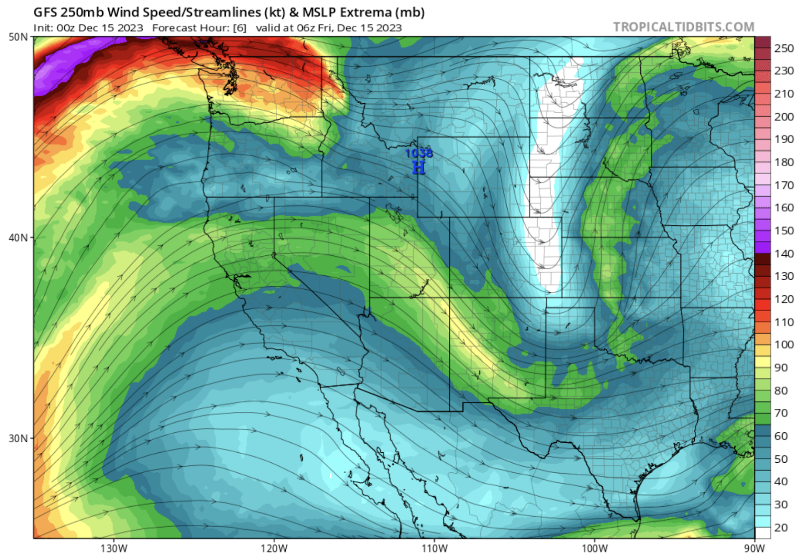
High pressure remains in control over Utah. Radar shows no precipitation over the state. There is an upper level ridge extending over much of the Western United States, while a trough axis is evident in the Great Plains. This trough and associated low pressure system is producing precipitation over the Southern Great Plains, mainly in the form of rain. There is an inversion present, with temperatures at the base of Alta registering at 18 degrees. The top of Collins recorded a temperature of 25 degrees.
Short term:
Model runs are showing continued quiet over the next few days as the high pressure system over Utah refuses to move out of the area. A storm could impact the California coast over the weekend but progress will be slow on that system.
Long term:
weather.utah.edu
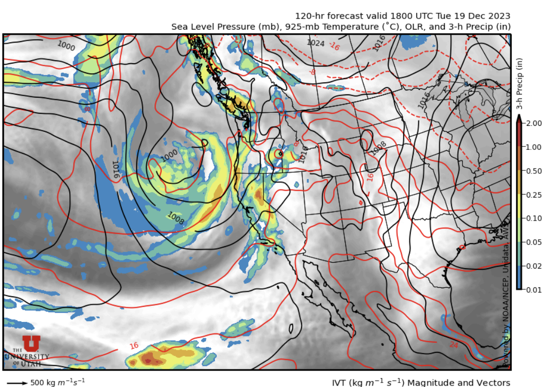
The low is forecast to slowly move inland and potentially drop some snow over the mountains of Utah in the middle of next week. It is too early to provide realistic snow expectations for that storm as it is questionable how much moisture will make it inland. Stay tuned for forecasts on that system as guidance becomes clearer!
Backcountry comments:
If you will be traveling in the backcountry make sure you have the proper equipment and know before you go. For the whole avalanche forecast and all things avalanche head over to our friends at the Utah Avalanche Center.
No comments:
Post a Comment