Saturday, December 31, 2022

More snow to head our way, so make your resolution to ski after New Years Day!

TL;DR:

Quick refresh for this morning and more on the way in the next 36 hours.


Nowcast:


Upper Little Cottonwood is reporting 4" and more from last night for a nice refresh this morning. There will a continuation of precipitation throughout the day. If you are planning on traveling to any ski resort make sure you have proper traction devices to travel safely and check out UDOT for road updates at https://cottonwoodcanyons.udot.utah.gov/ as there are planned road closures for the day.

White Pine Parking Lot (LCC) courtesy UDOT
   Low visibility/Stormy conditions at Hidden Peak courtesy Snowbird


Short term:


A bigger storm is on the horizon that is currently moving onshore on the west coast that will bring strong winds and rain into the Great Basin, this will bring a more snow into the area by tomorrow evening and Monday morning. So make sure to be safe if you are traveling in the next few days as NWS has issued a Winter Storm Warning for large areas of Utah.
Courtesy NWS


Long term:


The Current storm should bring a load of excitement as the holiday season comes to a close but for the locals who are going to be around next week will get another chance to enjoy some more snow. Thursday Night - Friday morning of next week is currently looking promising as GDPS is predicting around 10". After that there is another storm cycle hovering over the pacific. This is a promising look for the beginning of 2023 so make sure to find the latest updates on our website and enjoy the yuletide and new snow!

Courtesy SpotWX
(01/06) Courtesy U of U Department of Atmospheric Science


Backcountry comments:


Hazardous conditions Exist! If you will be traveling in the backcountry make sure you have the proper equipment and know before you go. For the whole avalanche forecast and all things avalanche head over to our friends at the Utah Avalanche Center.


Friday, December 30, 2022

THERE’S NO BUSINESS LIKE SNOW BUSINESS

TL;DR:

ACT 1 STARTS FRIDAY - DOUBLE HEADER SATURDAY.


Nowcast:

At or near freezing when the alarm goes off with a light breeze out of the south. Cloudy conditions to start your day are a hint of what’s to come.

Our opening act starts with light precipitation when lifts are spinning around 9am, approximately when dawn patrol is on their second lap. Backcountry skiers that resemble more human-oid forms will settle into their stride with 0.1 inches per hour of the snowy stuff.


Short term:

Temperatures are expected to rise as the thick atmospheric river (AR) starts to wring out over the Wasatch range. Valley temperatures could increase to 40F and see a snow to rain transition near lunch time. The Cottonwoods should stay below freezing near the mid-20s in parking areas.

The show continues to build and precipitation rates could reach 0.5 inches an hour during your lunch time intermission. There’s a chance 6 inches have fallen by the time lifts stop spinning. Exciting, yes, but hold your applause. The late-night talk show could crank up the precipitation intensity from 0.5 to 1 or 2 inches an hour, with 12 inches of accumulated snow by midnight and ANOTHER dozen inches before the alarm starts Saturday morning.

The double header continues Saturday with expected snowfall rates of 1 to 2 inches an hour throughout the entire day until midnight, potentially bringing accumulated snowfall to 3 or 4 feet. Higher totals possible, could be a day to bring your snorkel.


Anonymous snorkler, thank you Moving Mountains for the photo. Catch someone snorkeling the storm Saturday and you WIN 2022. #skicolorado 


Expect cloudy conditions (well, yah, they bring the good stuff) and increasing southwest winds during the Saturday storm. Temperatures could continue to rise at the parking lots and hopefully keep that freezing level halfway down the canyon roads.

Get an early New Year’s Cheers and use Sunday as the highlight reel to enjoy the deep stuff. Cooling temperatures follow a wind shift from the northwest while cloudy and light flurries start 2023 on the right foot. Cya later 2022 and thank you to the hard-working highway, transportation, patrol, operations and shift heroes helping get us up and down the canyons this weekend.


One schedule for the weekend, Canadian Regional (RDPS) output from https://spotwx.com/ at 7000ft


Long term:

Cooling temperatures with light dustings during the week. Another pulse of moisture could be in bound for next weekend, stay tuned to see how that plays out.


Backcountry comments:

Expect changing conditions and increased avalanche hazard. Intense, rapid loading of a buried weak layer could create the potential for very large avalanches as the storm continues. The snowpack needs time to adjust to the intense load and will have the potential to fail on buried weak layers 24-48 hours after the storm. 

If you will be traveling in the backcountry make sure you have the proper equipment and know before you go. For the whole avalanche forecast and all things avalanche head over to our friends at the Utah Avalanche Center here: Utah Avalanche Center


Image courtesy of https://www.mtavalanche.com/, the intense loading (stress) weakens the strength of the snowpack. Let's see how it responds and give it room to adjust. 


Thursday, December 29, 2022

Brace For Impact!

TL;DR: Skies are clearing and winds are calming as we see a brief period of high pressure today before a long-term storm system rolls in Friday morning, lasting through the weekend and into next week. Snowfall totals for Wasatch resorts are expected to potentially reach 60" by Sunday as an atmospheric river is pumping moisture into the area.

Nowcast: We are currently seeing mostly sunny conditions with a high in the upper teens today. Winds are currently out of the southwest and will calm down during midday. Winds are expected to pick up tonight into tomorrow. Ridgelines at 9000' will see winds of 5-15 mph with gusts <25 mph and ridgelines at 11000' will see winds of 15-25 mph with 40 mph gusts. Cloud cover will increase by tonight as the storm approaches. 

(Mt Superior, Alta :https://www.alta.com/weather) 

Short-Term (through Sunday): Expect snowfall to kick off Friday morning around 11 am. Warm air advection will raise Wasatch resort's daytime highs to the mid 20s and raise freezing levels for the valley which will see a mix of snow and rain. Wasatch resorts will see a steady and intense amount of snowfall lasting into Sunday morning reaching totals near 60". On Sunday a cold front will pass which will drop freezing levels back down to the valleys. The timing of the cold front passage is uncertain at this point. 

(SREF Alta, Utah Weather Center: https://weather.utah.edu/)

Long-Term Forecast: Snowfall will calm down Monday bringing only chances of snow. Temperatures will drop back down after the passage of a cold front on Sunday bringing daytime highs into the mid and upper teens. Due to the progressive weather pattern we are in, models become uncertain quickly so I won't comment much more about next week. However, it seems this fast pace pattern isn't leaving anytime soon. 
(GFS MSLP & Precip, Tropical Tidbits: https://www.tropicaltidbits.com/analysis/models/) 


If you are traveling into the backcountry, know before you go and visit UAC for avalanche and backcountry safety!


Wednesday, December 28, 2022

It's a Powder Day!

TL;DR: It's a powder day in the central Wasatch as resorts are reporting 12-20" of snow. Snow continues today and tapers off this evening. Another wet storm expected this weekend.

Nowcast: Resorts throughout the region are reporting over a foot of snow. Here are totals:

Brighton: 20"
Solitude: 18"
PCMR: 16"
Deer Valley: 14"
Snowbird: 13"
Alta: 12"

Here's Deer Valley's webcam as of 7:00 a.m. local time.

Source: Deer Valley

Note that this has been a right-side-up storm, meaning that the storm came in wet and fairly high-density, and transitioned to drier, low-density snow. This will make for excellent conditions that provide great flotation for skiing and riding.

Current radar imagery from the local KMTX radar shows the continuation of widespread precipitation this morning.
Source: University of Utah Department of Atmospheric Science

Short-Term Forecast:

In northwesterly flow, resorts will continue to see snow throughout the day. These snow showers will be more orographic in nature and have lower densities. The 1200 UTC HRRR model forecasts an additional 0.15 to 0.32 inches of liquid precipitation equivalent for central Wasatch resorts through this evening.
 
Source: University of Utah Department of Atmospheric Science

Assuming roughly 15:1 snow-to-liquid ratios in this cool northwesterly flow, this would translate to roughly 6 inches of additional snow for the central Wasatch. I do think we may see more than that if the right orographics come together, particularly in Little Cottonwood Canyon.

Mid-Long Range Forecast:

We clear out on Thursday and Friday, although we may see additional on-and-off snow showers as moisture from the Pacific Ocean tries to penetrate its way into the interior under southwesterly flow near the surface and westerly flow at upper levels.

Saturday is when the next storm arrives in earnest, and this one will be another wet one, with southwesterly flow in the prefrontal phase and high moisture transport from the Pacific Ocean.

Source: University of Utah Department of Atmospheric Science

The 0000 UTC European model valid at 0600 UTC on Sunday (around midnight local time), forecasts 700 mb (near mountain crest level) temperatures to be between -2 and -4 °C (see dashed red contours in the bottom left plot above). This would indicate that freezing levels would be around mid-mountain, so we could deal with rain at the lower elevations. Upper elevations will see snow, but it will be heavy and wet.

In the period from Friday morning through Sunday night, the 0600 UTC GFS downscaled product for Alta-Collins forecasts a whopping 3.5 inches of total precipitation. Remember that the snow will be dense, so snow totals will likely be a bit lower than we'd expect with this much water in the forecasts. Regardless, this is great for our mountains.

Snowfall Forecasts:

For today, expect an additional 5-10" of snow for the central Wasatch, with LCC most likely ending up on the upper end of snow totals.

For the storm on Saturday and Sunday, I don't want to begin to forecast specific amounts due to tricky snow levels and lots of moisture in this storm but expect multiple feet of wet snow in the Wasatch.


Avalanche danger has spiked to high today, so if you do venture in the backcountry be prepared and read the Utah Avalanche Center forecast before traveling.


Enjoy today's spectacular powder day!

Tuesday, December 27, 2022

Good Things Come to Those Who Wait

TL;DR:

A prolonged period of precipitation is beginning today in the Northern Utah Mountains. There is low agreement between solutions on the specific snow totals, but regardless this will be a significant series of events with the potential for all-time turning conditions by the New Year.

Nowcast:

Current conditions in the Central Wasatch are variable at best. If the powder itch just can't wait to be scratched, today you'll find windy conditions with warm temperatures and rain at lower elevations. Winds are gusting 50-80mph on the highest ridgelines. Hidden Peak at Snowbird hit 103mph this morning although I suspect this is not 100 percent accurate as Mt. Baldy has only peaked at 80mph. Temperatures are warm before the cooler air arrives later today ranging from 38F at 7000ft at the base of Park City, to 30F at 9000ft at Alta to 25F at the top of Mt. Baldy.

Currently snowing at Alta Ski Area this morning, looking West down Little Cottonwood Canyon. Image courtesy of Alta Ski Area.


Short-term Forecast:

A longwave trough and associated atmospheric river are making their way into Utah this morning, bringing lower-elevation rain and upper-elevation snow through Thursday morning. The trickiest part of this storm will be the snow levels. Atmospheric rivers are long-flowing regions of water vapor in the atmosphere originating generally in the subtropics. As they entrain sub-tropical moisture they also bring with them warmer air masses and higher snow levels. Today, the snow levels might be as high as 8000ft during the early part of the storm, bringing rain and mixed precipitation to the bases of Deer Valley, Park City Mountain Resort, and possibly Solitude as well. These levels will lower as the day progresses reaching below 6500ft by Wednesday morning. 

NASA GOES-West Visible Satellite channel this morning showing the Atmospheric River stretching thousands of miles across the NE Pacific Ocean and penetrating inland. Image courtesy of the College of DuPage.

Long-term Forecast:

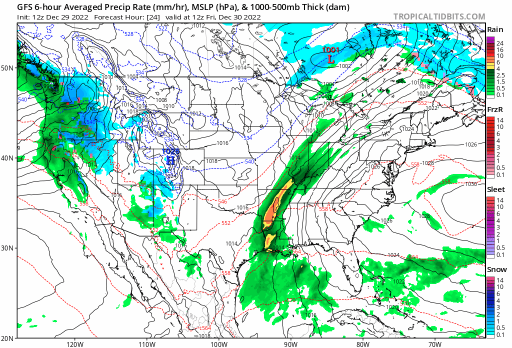
Another, potentially bigger, atmospheric river (AR) looks to impact Utah around the New Year with storminess continuing into 2023. This AR will make landfall in southern California and move to the Northeast, missing the highest terrain of the Sierra Nevada and bringing more widespread precipitation to Northern Utah. 

NCEP GFS Integrated Vapor Transport (IVT) and Mean Sea Level Pressure (MSLP) plot showing the inland penetrating atmospheric river, valid 11pm MST December 31. Image courtesy of the Center for Western Weather and Water Extremes at UC San Diego.

Looking even further out, the NOAA Climate Prediction Center keeps Utah with chances skewed for above-average precipitation through both the 6-10 day and 8-14 day forecast periods. In that period, it looks as though a quasi-stationary longwave trough will set up off the US West Coast. If that pattern stays close enough to the coast, we may be talking about an extended run of storms for the Intermountain West. Alternatively, this pattern could remain too far to our West, shutting us off past the 10-day period.

GFS Composite Radar Reflectivity valid 5pm MST Thursday, December 29 through 11am MST Monday, January 2. Image courtesy of Tropical Tidbits.

Snow Forecast through Thursday Afternoon:

Big Cottonwood (Solitude and Brighton) - 16 to 26 inches

Little Cottonwood (Alta and Snowbird) - 18 to 30 inches

Park City and Deer Valley - 6 to 14 inches for bases (~7000ft), 12 to 20 inches for upper elevations (~9000ft)

If you plan to travel in the backcountry ensure you are properly equipped and know before you go. For all things avalanche and the full avalanche forecast head over to our friends at the Utah Avalanche Center.

Unfortunately, I am out of the state visiting family so make some turns for me! I will definitely be living vicariously through everyone's stoke for what's setting up to be all-time late December conditions in the Wasatch. Enjoy!

Monday, December 26, 2022

Here she comes!

TL;DR: 

Snow will impact the region starting midmorning tomorrow and continuing through Wednesday afternoon. Highest snowfall rates will likely be overnight Tuesday night/Wednesday morning. There will be a break, and we will probably swear in the new year with another storm. 

Nowcast:

This morning looks slightly overcast due to the beginning of this storm. Here are the current conditions at Alta. 

Courtesy: Alta Ski Area

The temperature is around 30 degrees F, clear up to the summit. It should continue to warm up throughout the day to the mid-30s. 

Short-term:

More snow is on the way. A large-scale Pacific storm will make its way into Utah, carrying the critical ingredients for snow - moisture and instability. The beginning of the storm looks like it will come in warm, and there will be a frontal passage around midmorning on Tuesday. This is when the snowfall will likely intensify. We can easily see this when looking at the temperature and dewpoint forecast. Look for the jump in dewpoint and drop in temperature - this is the frontal passage. 


Courtesy: UofU ATMOS

The next question is, how much snow will we likely get? Lots of things are in play with this storm, but there is potential for serious accumulation and warmer weather, so good graupel skiing is possible. The HRRR model is saying ~2 inches of water through Wednesday at 5AM, whereas Jim Steenburgh's GFS-derived Cottonwood Canyon forecast is saying just under 2 inches. The SREF ensembles disagree with the lowest mean at 15 inches, and the highest mean at 30+ inches. I would put the total for this first storm through Wednesday evening around 25 inches in the mountains. Likely some valley snow accumulation as well, but not until Wednesday morning when the freezing level drops.  

Long-term:

This active cycle shows no signs of stopping in the GFS. We have another solid-looking storm around the New Year, and they just keep coming. I'll leave y'all with a picture that is the best Christmas gift I could've asked for. I'll take what we've got right now and knock on some wood hoping that it won't change. 

Courtesy: NRCS

Sunday, December 25, 2022

It's a Gift, But You'll Have to Wait

TL;DR:

    Merry Christmas and happy holidays to all. From all of us here at Utah Ski Weather, we hope your holidays are filled with happiness and dreams of deep pow. 


Stay cheery

It may not snow today

But the gift of pow is certainly on the way

Deep turns for some

Deep turns for all 

If everyone smiles

The snow will fall


Nowcast:

    Currently, temperatures are in the twenties with strong winds at the ridgelines coming out of the West. Clear skies will continue through the morning with scattered clouds as the day progresses. 

The start above Alta this morning, Alta


Short term:

    As the saying goes good things are worth waiting for. If snow is something good for you then be patient, your gift is on the way but Santa can't fit this in his bag. If we have all been nice this past year next week could deliver more of the Utah powder skiing we know and love. While we currently sit under a ridge of high pressure early next week the trough that follows will move inland. Monday we can expect the temperatures to rise slightly as the Southwesterly flow advects warm air into the area. Monday night the trough will make landfall with the storm arriving Tuesday.

This is Monday night, the trough axis is highlighted and will move inland through the night. As a result of the trough's orientation, strong Southwesterly flow will bring warmer air from off the coast of Southern California and the Baja prior to the storm's arrival. U of U Department of Atmospheric Science

Long term:

    Early Tuesday as the trough continues East mountain snow will be possible yet the freezing level could remain isolated to upper elevations. Tuesday night and throughout the day Wednesday the trough could deepen bringing cold air to the area from the North. Wednesday and Thursday will see the brunt of the storm with precipitation totals above an inch possible through the Wasatch. This could be another all-time storm but be patient, good things are worth waiting for.

    If you plan to travel in the backcountry ensure you are properly equipped and know before you go. For all things avalanche and the full avalanche forecast head over to our friends at the Utah Avalanche Center.

Friday, December 23, 2022

You Might Want to Stop Dreaming For a White Christmas

 TL;DR:


Today: Small amounts of snow in the evening in the upper parts of Utah such as Ogden and Logan. Otherwise, it’s pretty dry across the state.


3-Days: Nothing more for the next three days either. Rip open presents then rip up the groomers at the resorts. Try not to lose your head with the large lift lines too.


7-Days: Decent sized storm coming in for the 27th. It’ll start in the upper elevations of northern Utah and expand southeast towards Brian Head. Snow will also start to reach lower elevations as it builds. Cottonwoods and Park City Ridgelines should get decent amounts from this storm until it finally dies around the 29th.


Nowcast:


Today’s Forecast:


Wow what a fun little storm we just got for some great skiing yesterday. The biggest winners of that storm were our Little Cottonwood Resorts (Snowbird and Alta) with 13 inches. As for right now, well, we’re not completely dry today (Dec. 23rd). Very light accumulations of snow here in the state of Utah. Ogden and Logan areas in the evening should get minor amounts of snow. These totals are DEFINITELY not something to write home about but snow is snow, right? Otherwise, the rest of the state should be dry.


Short term:


3-Day Forecast:


So like the title says, you might not want to be dreaming for a white Christmas. The only precipitation we should see at all throughout the state for the next three days will be the small, evening of the 23rd, showers. To get snow any other time would be rarer than getting a hippopotamus for Christmas. My recommendation would be ripping open presents and then ripping up groomers.


Long term:


7-Day Forecast:

The first glimpse of snow that we will see will be the morning of the 27th and that storm should start producing snow in the higher elevations but you can expect some rain in the lower elevations. This storm looks like it loses some energy by the end of the day but comes back stronger on the 28th. During this time the lower elevations could expect to get more snow and the storm will expand towards southwest Utah. This means all of Utah will eventually get snow within the next 7 days. The best snow you’ll find is probably going to be in the Cottonwoods and Park City actually looks pretty decent too. This storm will continue with a pretty large presence all over the state until the 29th when it’ll fizzle out. Overall, the holidays unfortunately won’t have much snow, but you can expect a nice post Christmas storm to go out and use the new boards Santa put under the tree.


Santa rewarding himself with a job well done. ^


Backcountry comments:


Danger is Considerable in all areas except for the Moab area!


If you will be traveling in the backcountry make sure you have the proper equipment and know before you go. For the whole avalanche forecast and all things avalanche head over to our friends at the Utah Avalanche Center.


Thursday, December 22, 2022

Presents coming after Christmas this year.

TLDR:

    Pretty much dry until after Christmas, followed by an active pattern starting before the new year. 

Nowcast:

    It is currently 5F at the top of the Collins lift at Alta and 13F at the base. Winds are not as bad as yesterday, but it will still be gusty. 11" in the last 12 hours was reported by Alta will make the skiing soft and fun. Clouds will be persistent throughout most of the day, but the sun may peak through a few times. 

Highrustler and the Wildcat base, Alta Ski Area


Short-term: 

    Through the next 48 to 36 hours I expect a relatively small amount of snow to fall in the central Wasatch. Through Christmas we should expect 1-3" of snow to fall at Alta-Collins, with even less falling at lower elevations. Snow levels will drop to the valley floor, so there is a chance for some flurries on the benches. The windy pattern will continue throughout the week, but the winds should slow down as the week goes on.

U of U ATMOS
Long Term:
    Through Christmas the weather in the central Wasatch looks relatively calm, there aren't large snow totals until after Christmas. I wouldn't read too far into the models this far out, but I believe this shows a good chance for an active weather pattern coming to Utah before the new year. 
Dec 27th - 30th GFS Pivotal Weather


Backcountry Comments:

If you will be traveling in the backcountry make sure you have the proper equipment and know before you go. For the whole avalanche forecast and all things avalanche head over to our friends at the Utah Avalanche Center.


Tuesday, December 20, 2022

No today, Snow Tomorrow

TL;DR:

Not much during the day 12/20, chase for light flurries in higher elevations. System moving in late Tuesday night/early Wednesday morning has the potential to bring several inches to ski areas. Plumes predict 10 inches - 15 inches in the mountains and 0.5 inches - 1.5 inches in the valley.

SLC, U of U Atmospheric Science

Alta, U of U Atmospheric Science


Nowcast:

Current conditions are in the upper 20’s and light winds from WSW increase speed as you go up to the peaks. It’s a beautiful day today. The calm before the storm!


Short Term:

Models remain predicting a trough moving into Northern Utah late tonight bringing potentially 10 inches throughout the day. This system looks like it moves in quickly (tonight) and moves out (Thursday morning) just as fast. Unfortunately it looks like the center of the trough just misses us here in Utah. I’m not seeing great vertical motion in the models so I’m not confident that the plumes are accurate at 10 inches - 15 inches, maybe closer to 5 inches - 10 inches. There is however a slight chance of some lake effect snow for the valley moving into Thursday if the system moves in a little slower than models show.


Long Term:

We are however receiving very highly anomalous levels of precipitable moisture moving into Wednesday throughout the weekend. If favorable lifting conditions move in towards the weekend there is slight potential for some snow Christmas weekend. Temps should warm up as we move towards the weekend which might make the roads icy over nights. Remember to check back towards the end of the week for your Christmas forecasts to keep your holiday travels safe.


Happy Holidays!❄


Monday, December 19, 2022

TL;DR:

Sunny skies for today with temperatures in the upper teens and low twenties. Chances of precipitation are likely starting Wednesday afternoon and throughout the week.


Nowcast:


Beautiful day today with sunny skies and max temperatures in the upper teens and low twenties. A low breeze will be felt at the base of the mountains with a strong breeze at the peaks coming from the west. Wonderful day to be enjoyed!


Short term:


Currently, we are under a high-pressure system, but that will soon change Wednesday afternoon as a trough enters through northern Utah. This will bring high chances of precipitation. Possibility of precipitation totals of around 0.2 - 1 inches and snow totals of 5-10 inches.


Long term:


As this trough progresses through the state, another short wave trough from the west makes its landfall Friday afternoon. Precipitation is likely from Wednesday afternoon until Monday.


Backcountry comments:


If you will be traveling in the backcountry make sure you have the proper equipment and know before you go. For more information visit the Utah Avalanche Center.

Sunday, December 18, 2022

Bluebird Is The Word

TL;DR: 

    Following a week that will go down in the history books we are entering a period of high pressure. Break out your sunscreen and smiles as it will be nothing but sun shining for the foreseeable future.

Nowcast:

    As we continue to enjoy to goods from an all time storm the skies remain clear with temperatures in the low twenties dipping to the upper teens along the Wasatch ridgelines. Winds are calm out of the West, Southwest. If your heading to the hills for some holiday turns be sure to pack the sunscreen as the sun will be shining and the sky blue. 

Take a peak from the top of Collins, note the smog in the valley. Alta


Short term:

    Over the next few days as we sit under higher pressure the skies will remain clear and the temperatures cold. While there is nothing exciting to be shown for on any model, the excitement in the hills is high. The only thing we'll get a lot of over the next few days are tourists coming to enjoy our beautiful mountains.

Long term:

    As mentioned before there isn't anything super promising in the models. For those who enjoy storm leftovers get them while the getting is good, for others, it might be time to break those on-piste skis back out and sharpen your edges. If you will be heading to the mountains try to carpool as we are in inversion season and can all do our part to limit the SLC smog we all know too well. 

Todays inversion climbed high to about 800 mb which sits near the bottoms of our Cottonwood Canyons. NWS SPC

    As Usual if you plan to travel in the backcountry ensure you are properly equipped and know before you go. With the large amount of snow we have seen, fatal avalanches are possible. For all things avalanche check in with our friends over at the Utah Avalanche Center.


Friday, December 16, 2022

What a week!

TL;DR:

Cold and clear. We are now in Steenburgh Winter! Inversions and fog likely over the next week. More active weather possible in the later half of next week.

Nowcast:

An amazing week comes to a close. I hope y’all got up in the mountains for some delicious pow. We are now in what is known as Steenburgh Winter, as the snow depth at Alta-Collins reached 100”. For further discussion of Steenburgh Winter, check out Jim Steenburgh’s blog linked in the side-bar. It will be cold in the mountains today and likely for the rest of the weekend, with highs around 15F and lows near 0F. Ridge gusts not exceeding 40 mph. Skies will be mostly clear.


Alta-Collins snow depth from NWS

Short term:

With the large trough exiting the region, we enter a more stable ridging pattern. With the remaining snowpack, chances of fog and inversions are higher. Temperatures are expected to be well below normal (15F below average for this time) with gradual increases back to normal up until late next week.


Long term:

Temperature inversions are likely in the long term range as temperatures gradually return to normal. A Pacific Northwest ridge is making its way into the region on Wednesday, bringing northwesterly flow. The exact location of the ridge is uncertain currently. Uncertainty in the long-range increases towards the end of the week with models diverging.


Satellite imagery from SSEC this morning showing the Near-IR - "Snow/Ice" (1.6 µm) band


Backcountry comments:


If you will be traveling in the backcountry make sure you have the proper equipment and know before you go. For the whole avalanche forecast and all things avalanche head over to our friends at the Utah Avalanche Center.