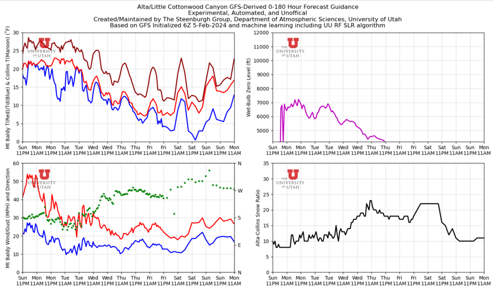
TL;DR: A strong storm in the Pacific will penetrate inland today bringing snowfall to Northern Utah. The longwave trough associated with this storm will affect most of the Southwest United States through Wednesday. Another trough merges into the existing longwave later in the week bringing more chances for snowfall. The longwave trough affecting us for the first part of this week is bringing warm moisture from our south which will continue to keep temperatures rather warm and snow levels around 6000-6500 ft.
Nowcast: It is currently 32 F at the base of Alta and 23 F at
the top of Collins. Expect winds to remain moderate throughout the day from the
South. Wind magnitudes are trending downward throughout the week.


Long-Term: Another trough dips into the region on Thursday and
merges with the existing longwave. This extends the period of unsettled weather
through the rest of the week. It is difficult to tell where the best dynamics
will fall within this large system, so expect spotty snowfall for the remainder
of the week as this low-pressure system migrates through. Snow levels dip down
to the valley floor by Thursday night as temperatures trend downward throughout
the week.
Backcountry Comments: With new snowfall and strong winds make sure you knowbeforeyougo and visit UAC before heading into the backcountry.
No comments:
Post a Comment