TL;DR: We will have a quiet start to the week as we wait for a shortwave system with favorable upper-level dynamics and moisture transport to hit Wednesday morning.
NOWCAST: Alta has gotten 4" in the past 24 hours and is currently 21 F at the base with light WNW winds. High pressure currently dominates the region.

(Alta Ski Weather: https://www.alta.com/weather)
Short-Term Forecast: Wednesday morning a shortwave trough will barrel through the region coupled with good IVP from an atmospheric river penetrating through California. Winds at the 700mb level (~11,000 ft) will be positioned from the SW during the arrival of this storm. Storm snowfall totals range from 30"-50" at Alta. 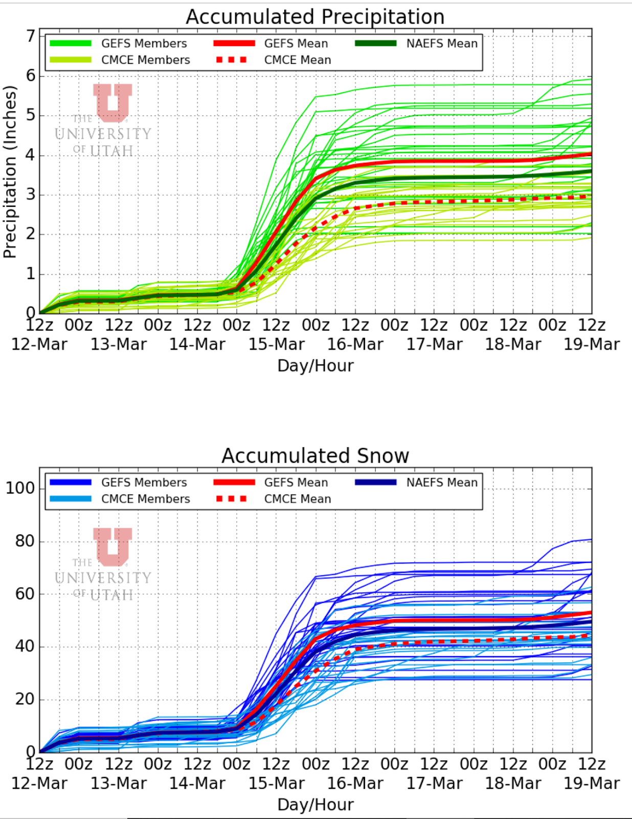

(University of Utah NAEFS, https://weather.utah.edu/)
Long-Term Forecast: After the trough passage on Wednesday, slightly high pressure will build into the region for the rest of the week. Smaller feature shortwaves are possible throughout the rest of the week but none will bring considerable snowfall. Our weather pattern seems to stay very progressive and this next ridge will be quickly pushed out by a deeper trough early next week.
(500mb Geopotential Height Anomaly, Tropical Tidbits: https://www.tropicaltidbits.com/)
No comments:
Post a Comment