Nowcast:
 |
| 09:42 MTN / 15:42 UTC Camera Display looking EAST from the Neil Armstrong Academy in West Valley. Via https://home.chpc.utah.edu/~u0790486/wxinfo/cgi-bin/uunet_camera_explorer.cgi?cam=NAA |
 |
| Current Temperatures and Wind Direction around I80 and the Cottonwoods. Via https://mesowest.utah.edu/cgi-bin/droman/mesomap.cgi?state=UT&rawsflag=3 |
Overcast skies with cloud layers at 5500 ft, 12000 ft, and 14000 ft according to the KSLC METAR (KSLC METAR) for 1454z. Winds are from the south at 16 mph at the airport, consistent with ridge top winds at Hidden Peak blowing 25 mph with gusts to 40 mph.
Temperature is in the low 50s in the valley and just below freezing (low 30) up at the ski hills.
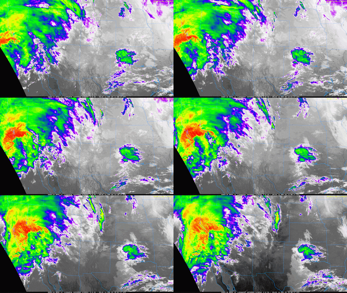
Satellite / Infrared imagery shows a 'big red lobster' i.e. the remnants of an atmospheric river heading our way from the southwest. This atmospheric river brings moisture, and unfortunately warmth, to the region.
 |
| Infrared imagery with the incoming atmospheric river as an 'angry lobster'. Via https://weather.cod.edu/satrad/?parms=regional-southwest-14-24-1-100-1&checked=map&colorbar=undefined |
Snow is expected to start late this afternoon bringing 3" before midnight and another 15" by sunrise tomorrow. Winds are expected to be ripping during this event with consistent gusts exceeding 40 mph.
Snow continues throughout Wednesday with another 12"(ish) to fall during the day.
Freezing levels should remain above 7000 ft until a cold front barges through Thursday morning.
This incoming storm has prompted a Winter Storm Warning from NWS/NOAA with 'Significant Mountain Snow Accumulations'.
 |
| Tuesday afternoon through Wednesday Morning - expect mountain snow courtesy NWS/NOAA https://www.weather.gov/slc/ |
Long term:
The cold front will turn off the tap until shortwave troughs move through this weekend, potentially bringing precipitation on Saturday or Sunday.
Backcountry comments:
Winds and loading contribute significantly to snowpack instability. Changing temps as they increase or drop with the cold front will increase the likelihood of natural and human triggered avalanches. Be mindful of the intense winds and dense upper snow layers as they can be a bed surface for the new storm snow to slide on.
If you will be traveling in the backcountry make sure you have the proper equipment and know before you go. For the whole avalanche forecast and all things avalanche head over to our friends at the Utah Avalanche Center here: Utah Avalanche Center

No comments:
Post a Comment