Happy Thanksgiving!
TL;DR:
A couple inches of snow freshened up the Wasatch yesterday, now we head into the weekend with sunny skies as we await our next storm on Monday.
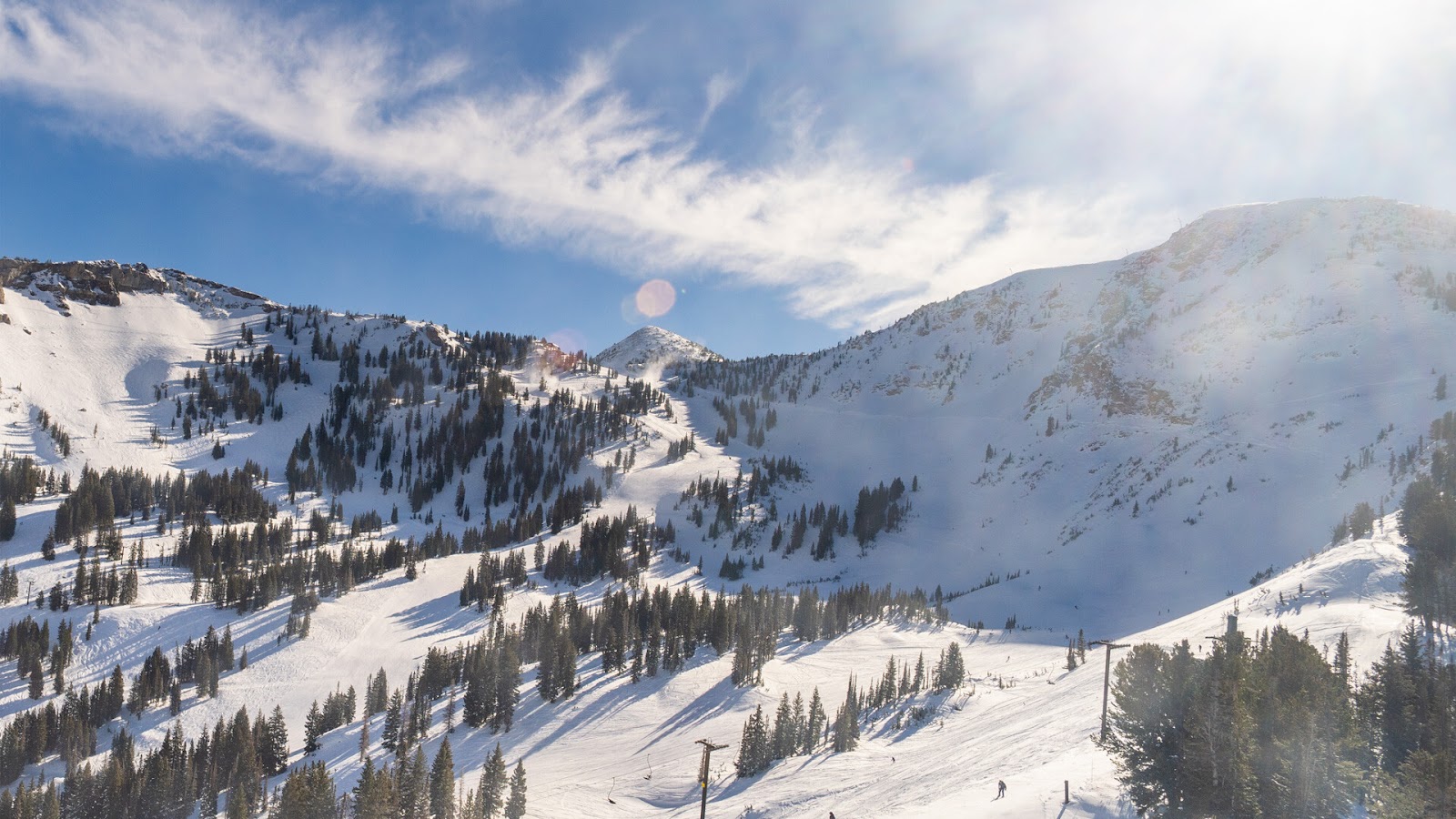
Mount Baldy Webcam via Alta.com
Today I am thankful for the deep snowpack we have this early in the season! It's mostly sunny in the mountains today with temperatures not exceeding 30 degrees. Wind is blowing from the North at 10 to 15 mph. High pressuring is building in the region until tomorrow bringing us dry and stable weather.
Short Term:
High Pressure has taken a hold on us, giving us some sunny yet cooler days of skiing ahead. Temperatures will rise 5 degrees at all elevations tomorrow and the inversion will continue to build. On Saturday a weak cold front will move through Northern Utah bringing down the temperature with wind increasing. Likely not enough to blow out the inversion.
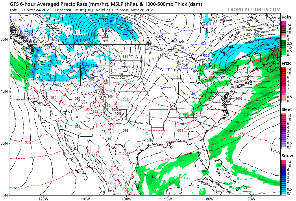
GFS 6-hour Averaged Precip Rate via Tropicaltidbits.com
Long Term:
The shortwave trough will pass through Sunday afternoon, and any precipitation is expected in the morning if any. Another trough from the the Gulf of Alaska will enter the region Monday morning and will last through the day. It should bring accumulation to the valleys and more to the mountains. Temperatures will be cold, but the mountains could see up to a foot of snow. I'm hoping that low pressure is making its way back into the region to stay.
The backcountry conditions have been stable for a while, but once we get our next storm the danger will rise fast. If you will be traveling in the backcountry make sure you have the proper equipment and know before you go. For the whole avalanche forecast and all things avalanche head over to our friends at the Utah Avalanche Center.
-Ben
No comments:
Post a Comment