TL:DR:
We are getting dumped on, and this storm will continue
through tonight taking us into a dry period until late next week.
Storm snow totals:
Alta: 25”
Snowbird: 23”
Brighton: 22”
Solitude: 23”
Park City: 18”
Deer Valley: 20”
Snowbasin: 12”
Powder Mountain: 20”
Nowcast:
We are in the thick of it. Alta is reporting totals so
far for this storm at 25” with nearly 3” of water. Currently, up in the
cottonwoods, the snow is coming down hard, and temperatures are in the low 20s and
dipping down into the teens up around the mountain tops. Winds are blowing out
of the W, WSW. Snow will continue throughout the day and slow down as we move
into the evening yet will pick back up around 10 – 11 to bring another inch or
two.

Short term:
Moving into the end of the week the weather is going
to calm down, as this storm moves out of the area late tonight the moisture
will go with it yet the cold temperatures will remain. Moving toward the
weekend a shortwave trough could move in our direction bringing a small potential
for some trace precipitation, the greatest limiting factor will be moisture
availability.
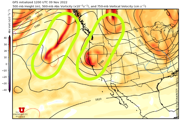 |
| Valid 0000 UTC Sunday 13. These are the two small-scale features that we will see this weekend and early next week, at the moment the moisture is our limiting factor but we will have to wait and see how these develop. U of U Department of Atmospheric Science |
Long term:
Looking forward to next week we are due for a moment to recover from this week’s storm. Models are currently showing a couple of small-scale features that may come in our direction, but moisture will continue to be a limiting factor. Temperatures will remain cold in the mountains.
If you are going to be traveling in the backcountry,
ensure to have the proper equipment and adhere to any backcountry closures.
Find all things avalanche including the forecast and observations from our
friends over at the Utah Avalanche Center.
No comments:
Post a Comment