TL;DR: THUNDER 'N' LIGHTNING
Nowcast:

Unsettled Morning in Salt Lake City - Light rain transitions to snow at Parley's Summit. City Cam: https://home.chpc.utah.edu/~u0790486/wxinfo/cgi-bin/uunet_camera_explorer.cgi?cam=WBBW
 |
| UDOT Road Weather Cam via http://udottraffic.utah.gov/ |
Moderate temperatures to start the day before a cold front pushes in this afternoon. Risk of thunderstorms!
Short term:

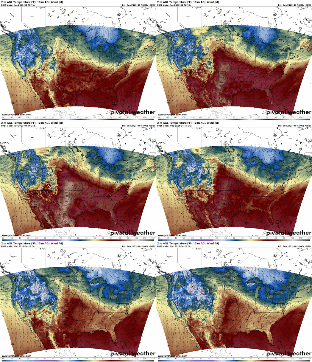
Forecast loop showing surface temperatures and surface winds. A blob of blue brings wind and cold air out of the northwest today. https://www.pivotalweather.com/model.php?m=hrrr&p=sfct_b-imp&rh=2023041800&fh=gif&r=conus&dpdt=&mc=
Straight model output (HRRR) below shows minimal snow for the Wasatch, however a Winter Weather Advisory is calling for 6-12" up high. https://www.weather.gov/slc/WWAmap?id=https://api.weather.gov/alerts/urn:oid:2.49.0.1.840.0.c3d190f7fc7acf8bbab9322a00d7ac789a683999.001.1#ACTIVE. Brush off the Mountain Biking pads and get that jacket out, temps dropping below 20F in the mountains overnight.
 |
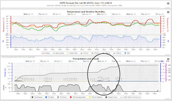
| Point Forecast in the Wasatch Mountains showing 0.20" of precip... "woohoo".. and temps dropping below 20 overnight. Via https://spotwx.com/products/grib_index.php?model=hrrr_wrfprsf&lat=40.65272&lon=-111.64633&tz=America/Denver&label= |
Cooler temperatures to persist after the current round of instability. There's a possibility of some early-week precipitation (3-4") to start Sunday overnight through Monday.

Maybe a couple of inches Sunday overnight into Monday. TBD!
Backcountry comments:
If you will be traveling in the backcountry make sure you have the proper equipment and know before you go. For the whole avalanche forecast and all things avalanche head over to our friends at the Utah Avalanche Center here: Utah Avalanche Center